Sentiero 785 inglese


![]()
Nature Path ![]()
Ragalna – Etna Altomontana trail
Hiking routes to discovery Ragalna’s territory
PREMISE
Paths 785 and 785A were designed and built by the Belpasso section of the Italian Alpine Club, thanks to the push and contribution of the Municipality of Ragalna. It was wanted to connect the town of Ragalna to the existing Etna trail network, created by the Etna Park. Path 785 leads to the Etna Altomontana trail, the main itinerary of the Etna trail network, through which the hiker can then continue visiting the mountain area. The path runs through the north area of Ragalna Municipality, punctuating some sites of naturalistic interest in the area, described on the information tables on site.
The route has a development of about 9km and a difference in height of almost 800 meters from the starting point to the arrival point.
ITINERARY
It starts from Piazza Rocca in Ragalna (Point 1, 917 meters above sea level). From here, following the sign and the characteristic white-red flags, head west on Via Cavaliere and runs along the northern area of the town of Ragalna. Along the way it is possible to observe what remains of Villabona estate, belonging to the Moncada princes. It was the largest of the eighteenth-century Ragalna and included a two-story building, a millstone, a chapel (no longer visible), a large cistern and the houses of those directed the agricultural work. Prince Giovan Luigi Moncada took refuge there around 1780, fleeing the unrest that broke out in Paternò for the nationalization of private properties of that Municipality, which he will oppose until the decline of his feudal rights in 1812. Nearby, beyond via Cavaliere, other ancient villas can be admired, including Villa Pulvirenti which houses a still undamaged millstone, dated 1742, and the first chestnut planted in the area.
At the end of via Cavaliere, after about 1 km, at the intersection with via Grotte Catanesi there is Point 2. From here, it is possible to make a detour to visit the two Catanese Caves 1 and 2.
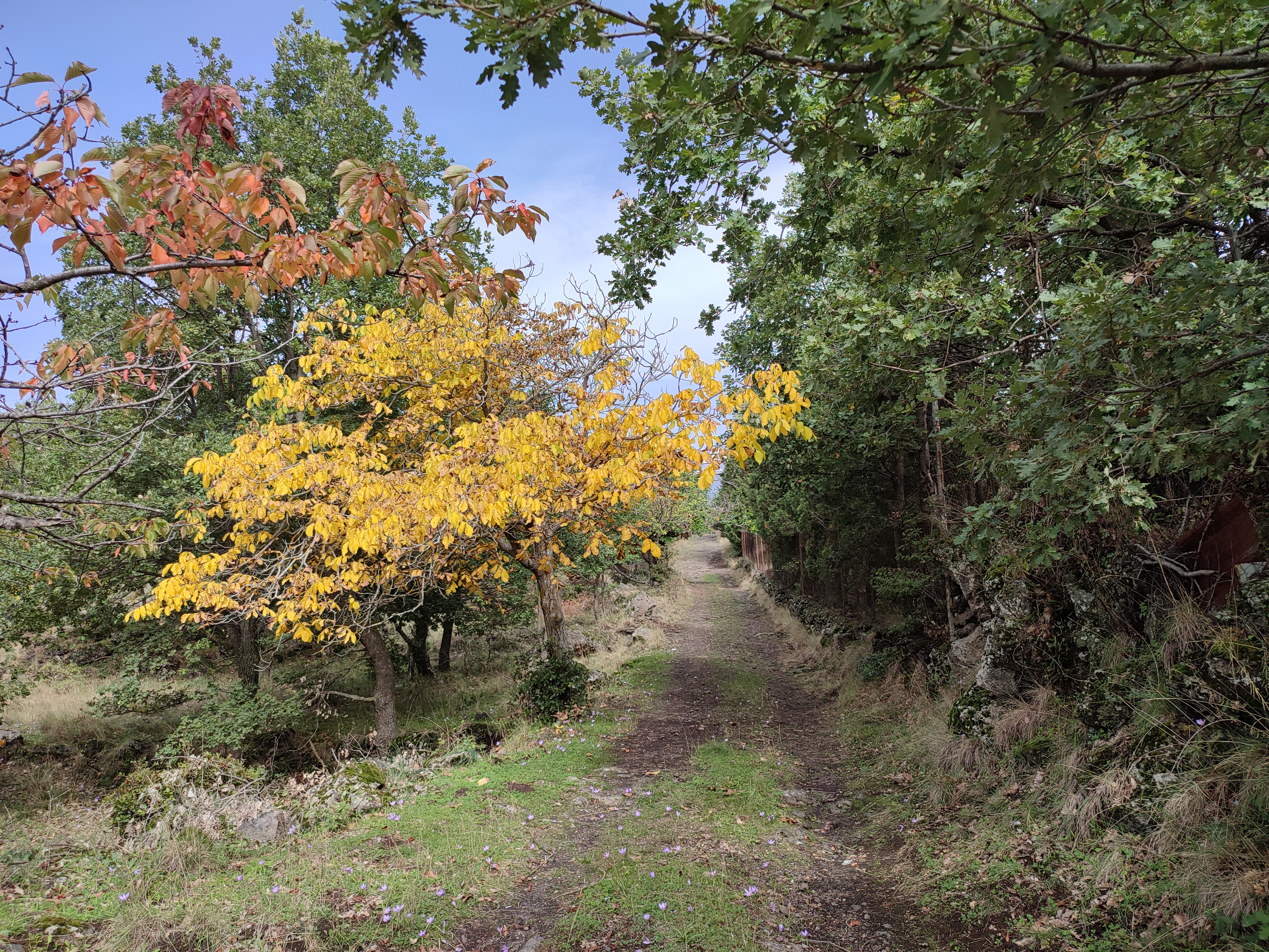
Instead, Path 785 heads north on via Monte Arso. Keeping to the edge of the asphalted road, you walk about 400 meters to reach “Grotta delle Scupettate” (point 3, 917 m.a.s.l.) a small lava flow cave lies under the perimeter wall of an agricultural land. The changes brought about by the numerous collapses are noteworthy. At its edge it is possible to collect the “cannatedda” (called Strigoli in Italian), an edible herb known since ancient times with a delicious taste. Just in front of the cave, you can admire a grove of oaks, a remnant of the original forest of Mt. Etna.
Continue uphill on asphalt for about 100 meters to the point where the asphalted road surface gives way to a characteristic lava pavement, characterized by two smoother longitudinal strips that once served to facilitate the wheels of the carts. Continuing uphill, we enter in Mollecchina district, a wooded area characterized by the Mediterranean scrub with beautiful holm oak trees, oaks and specimens of broom.
When into a curve the bottom becomes dirt again, here we are in correspondence of the entrance to the panoramic Ardizzone farm, now renovated and transformed into the Boscoscuro agritourism. The truck becomes narrower here, continuing it is possible to see the top of Mount Arso (1102 m.a.s.l.), the cart road climbs alongside the mountain to the east until it reached a crossroads (Point 4, 1081 m.a.s.l.), in the near a large oak tree. From here, through a steep path, it is worth reaching the top of the mountain for a panoramic view of the surrounding area.
Taking up the path, continue straight on the cart track for about 700 m, now narrowed and bordered by the typical dry stone walls characteristic of the Etna area. We enter the wood of Paternò, then arrive at an intersection, turn left and, immediately after, turn right to the second intersection. From here, about 100 m, in correspondence of a compact lava outcrop, the characteristic signpost tables indicating us to leave the cart track to enter on a small path that plunges into the woods. Along this path, after a few dozen meters, an indication invites us to take a short detour to exit the wood and be able to see a characteristic lava formation, a cannon-stone formed on one of the most extreme lava arms of the 1780 eruption. Back on the main path and continuing on it, you will come out on a small road, at times paved, near some holiday homes, some of them now ruined. Follow it for about 600 m avoiding deviating at crossroads, until you reach an appropriate signal that invites you to deviate north on a path, that in a dozen meters, widens and becomes an uphill dirt road you come out on the “Ex trazzera San Leo-Milia”, known as the Milia road (point 5, 1275 m.a.s.l.). You pass the asphalted road and continue along the cart track toward the north for about 1.5 km, leaving the detours to the right and left, accompanied by the wonderful view of Mount Etna in the background. As soon as the narrow road deviated to the west, take a path that leads to the east and forward through the vegetation until it brings us near the “Grotta dell’Immacolata” (Point 6, 1469 m.a.s.l.), a lava cavity characterized by three different rooms. Near the cave, in a few dozen meters to the south, there is an ancient construction of the shepherds called “pagghiaru ‘n petra”, still well preserved.
Once back on the path, head north for about 300 m, coming out onto a small road with an asphalt surface in poor condition already. Here you turn right and continue; the road heads west before flat and then leading up, makes a few hairpin bends between lava flows and wooded areas. Just after a bend there is a crossroad, turn right onto a path that runs along the edge of a lush chestnut wood for about 400 m. Then, you leave the wooded stretch and turn off to cross another arm of the lava flow of 1780 in a west-east direction, on an ancient and characteristic path built on the sciara: it was probably used in the past for the exploitation of the forest.
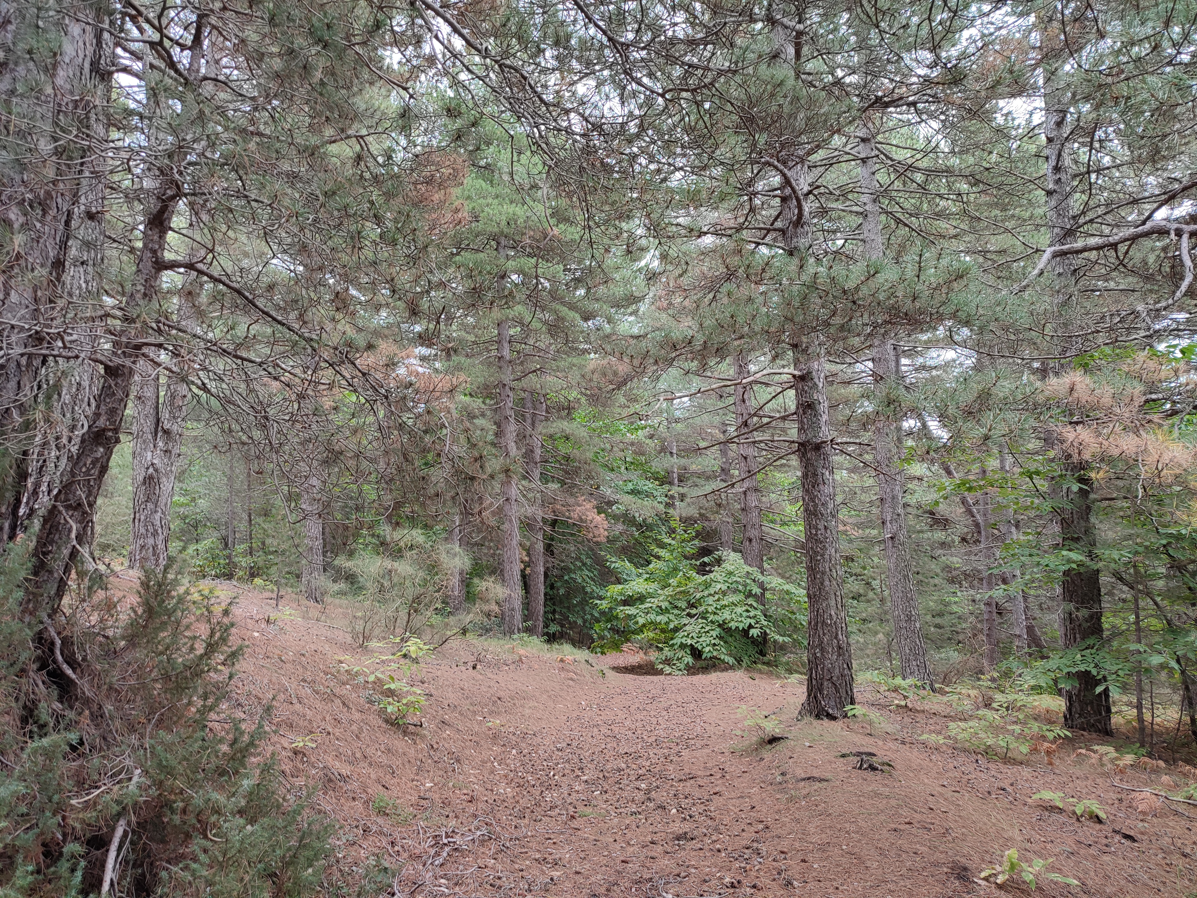
After the flow and re-entering the wood, go up northward through wide paths that plow through the mixed vegetation of pines, broad-leaved trees and gorse. You pass again a small lava arm and back in the woods you reach the edges of Serra la Nave district, nearby the homonymous mountain. After a short stretch you meet the confluence with path 786B (Point 7, 1692 m.a.s.l.) which climbs up from Mount Manfrè Refuge. The surrounded area is characterized by a pine forest with specimens tall trees. Continue and in about 200 m you reach the gate of the Filiciusa-Milia State property (Point 8, 1700 m.a.s.l.) where the Etna Altomontana begins, first characterized by the 701A sign and then by the 701SI which coincides with a stretch of the Etnean variant of the Italian CAI Path.
Nearby there is the Ariel shelter, useful for a short break or to stay overnight and leave the next morning. From here, various excursions are possible on the southern side of Etna or take the Altomontana Trail, a path that circumnavigates Mt. Etna until you reach the Ragabo pine forest of Linguaglossa town on the north side of the volcano.
Directions to the starting point (Point 1 – Piazza Rocca-Ragalna):
From the Paternò - Catania / SS121 highway, continue on the SS 284, take the Santa Maria di Licodia-Belpasso exit , keep right at the crossroads and enter the Provincial Road 4/11. Continue for about 2 km, then turn left onto Via Mongibello; follow it for 2.3 km, then continue on Via Paternò, piazza Cisterna, via Rocca (also SP 57) until you reach Piazza Rocca.
GPS coordinates of the paths 785 e 785A starting points (Point 1 – Piazza Rocca-Ragalna):
Lat: 37° 38,592’ N; Long: 14° 57,442’ E; Alt: 917 m.s.l.m.
POINT OF INTEREST - DESCRIPTION
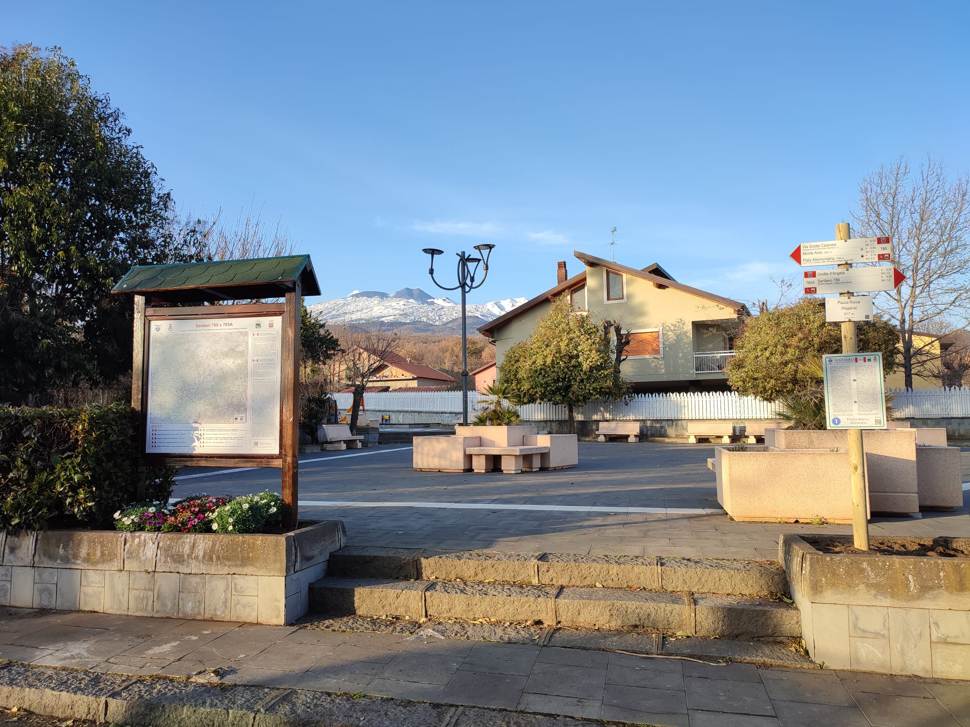
Point 1 - Piazza Rocca (Ragalna)
The intersection between the high-mountain road of the Byzantine period, which connected the towns of Taormina and Adernò, and the road that from Batarnù (Paternò) led to the woods of Mt. Etna, is reported for the first time in a Norman document of 1137. It also mentioned the cistern, called “Gervasio’s cistern”, which is today next to the ruined millstone, dating back to the mid-1700s, located on the right of the square.
All around there was a fenced area for grazing and vineyard, surmounted by elevated Rock which gives its name to the square. The place was called Rachalena (from the Arabic Rahal Ayn = Water House): from it derives the toponym of Ragalna. It was therefore a fief of Benedictines of the monastery of San Leone al Pennacchio and, after its destruction caused by the eruption of 1536, to the Moncada princes of Paternò, it will be granted in emphyteusis starting from 1732 to numerous Paternese citizens who will plant renowned vineyards, millstones, rural churches, villas of which traces remain in the surrounding area (in particular the Savuto villa, on the left going down via Rocca), giving rise to the first inhabited center of the modern Ragalna.
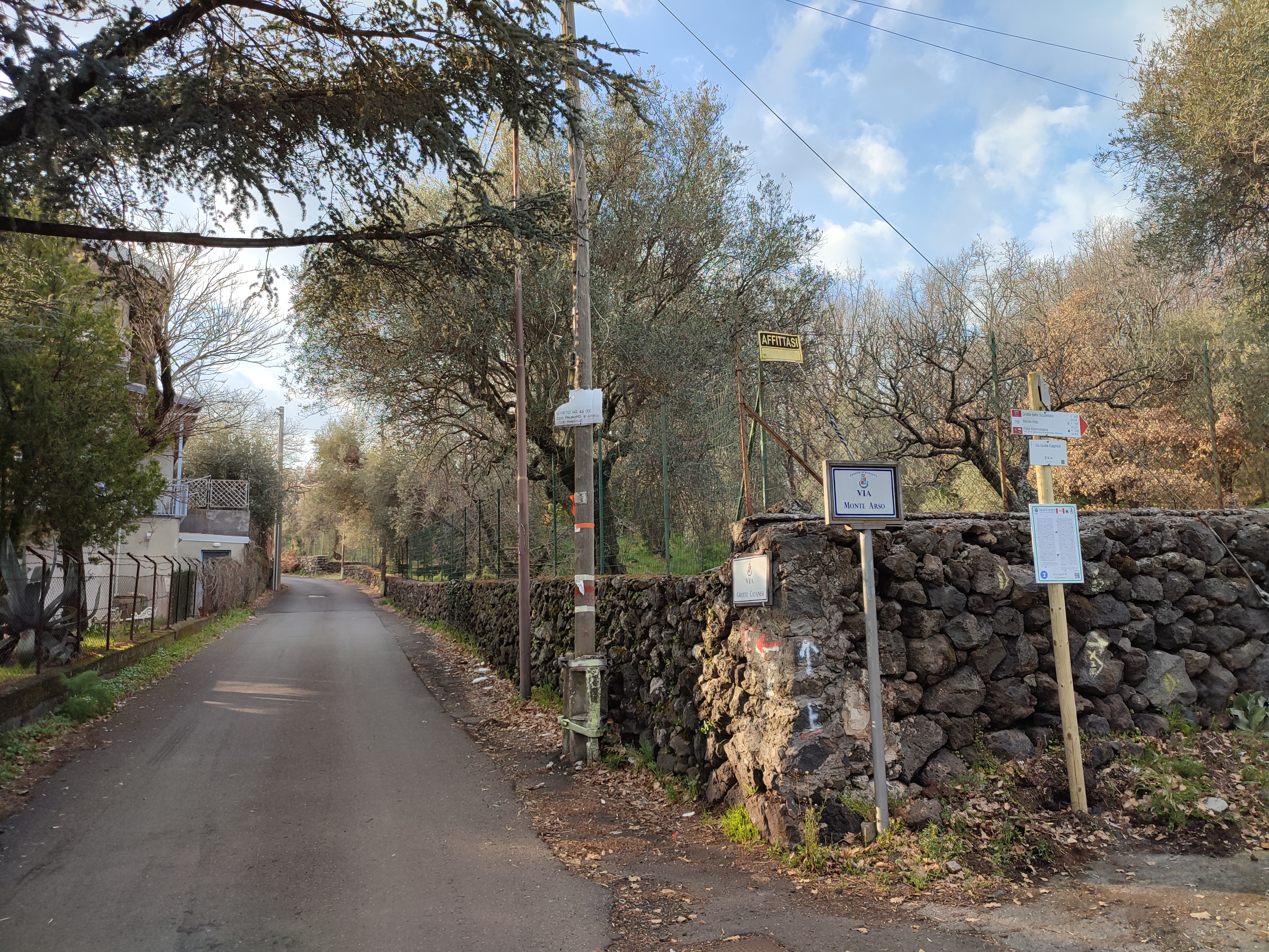
Punto 2 - Via Grotte Catanesi
Going along a path to the left of the road that lead to Mount Arso, after about 500 m, it is possible to visit two lava flow caves called “della Catanese”, the first of which is a wide basilica-shaped cave (the largest of Mt. Etna: on July 1943 it hosted the population of Ragalna who escaped the allied bombing), made by the eruption that gave life to Mount Arso. At the base of the east wall, a narrow passage opens up with a tunnel about 70 m long, inhabited by bats, in which bones and small fragments of ceramic have been observed.
Around the two caves there is sparse forest of holm and downy oaks, a true paradise for lovers of “funci di ferra” (ferula mushrooms or pleurotus eringii) and wild asparagus, where it is possible to meet ancient peasant dwelling in lava stone, turrets and “pagghiari in petra” (small arched buildings that were used to store food or as a refuge of farmers and shepherds), “pietre-cannone” (lava stones with the typical shape of a cannon) and characteristic lava flows, vaguely animal-shaped, popularly called “stone dragons”.
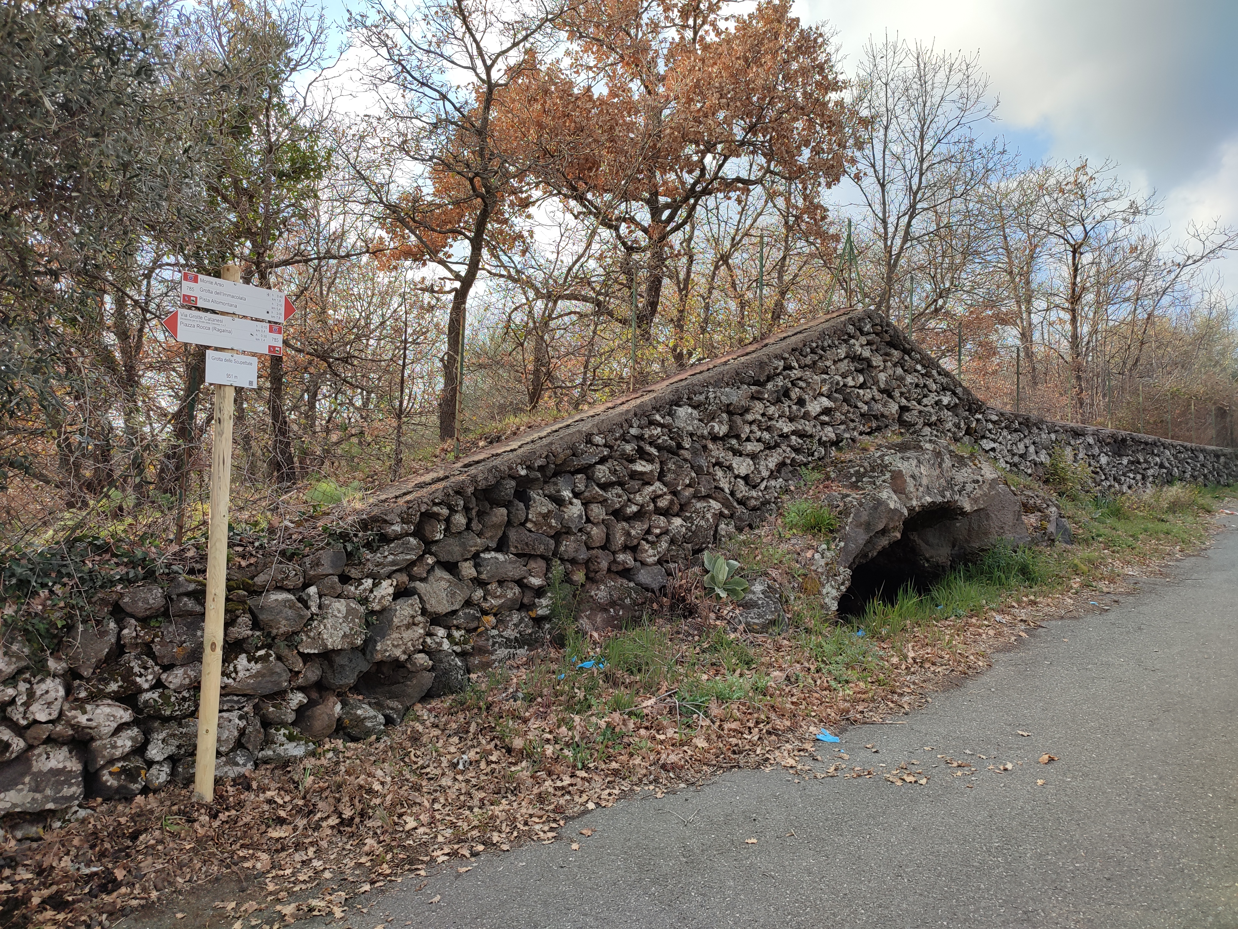
Punto 3 - Grotta delle Scupettate
Lava cave that lies under a dry stone wall along the Via Monte Arso.
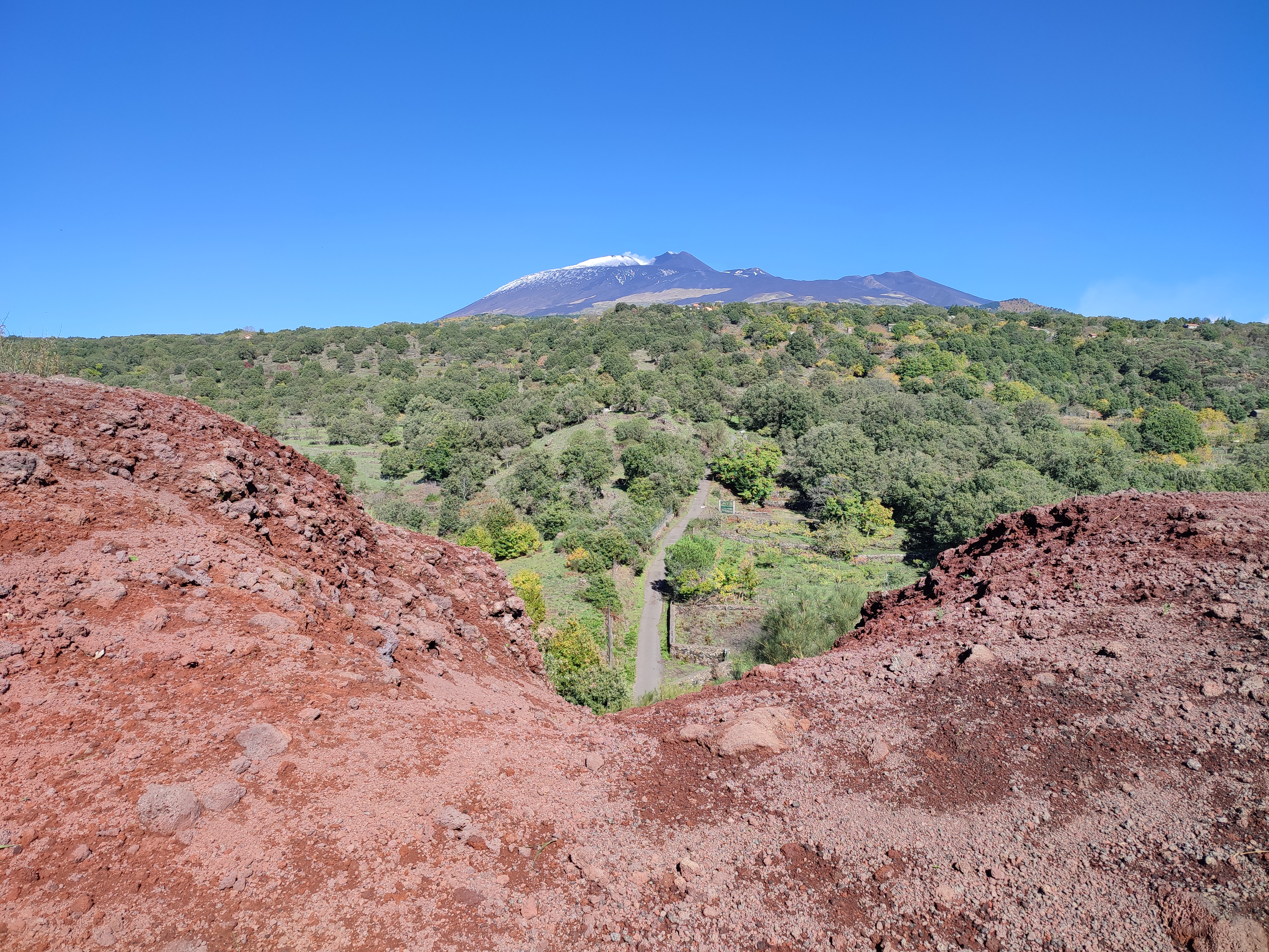
Punto 4 - Monte Arso del Cavaliere
Monte Arso del Cavaliere is an old crater dating back to 500 BC. After an easy climb along a short path, you reach its two peaks from which you can admire a double panorama: to the north, the majestic peak of Mt. Etna; to the south, the valley of Simeto river to the sea and the lake of Lentini. The site of community interest – SCA (special conservation area) – covers 124 hectares, falls at altitudes between 900 and 110 m.a.s.l. and is characterized by ancient lava flows.
The bioclimate is part of the lower subhumid meso-Mediterranean. Wood formations are well represented, such as deciduous oak woods denominated by Quercus virgiliana, often mixed with woods of Quercus ilex.
The present of Celtis tournefortii subsp. Aetnensis (hackberry of Etna) is significant.
Therefore are found scrubs of Genista aetnensis. Of particular importance is the presence of deciduous and evergreen forest formations, with various entities that in the regional area are rare or considered to be of significant phytogeographic interest. The site is used as a foraging and resting area by the golden Eagle and as a breeding site by the Sicilian Rock Partridge. The invertebrate fauna is relatively diversified with numerous endemic species.
Source: Ministry of the Environment, Natura 2000 Form.
Punto 5: Strada Milia
The old Milia San Leo road to cross to continue the route.
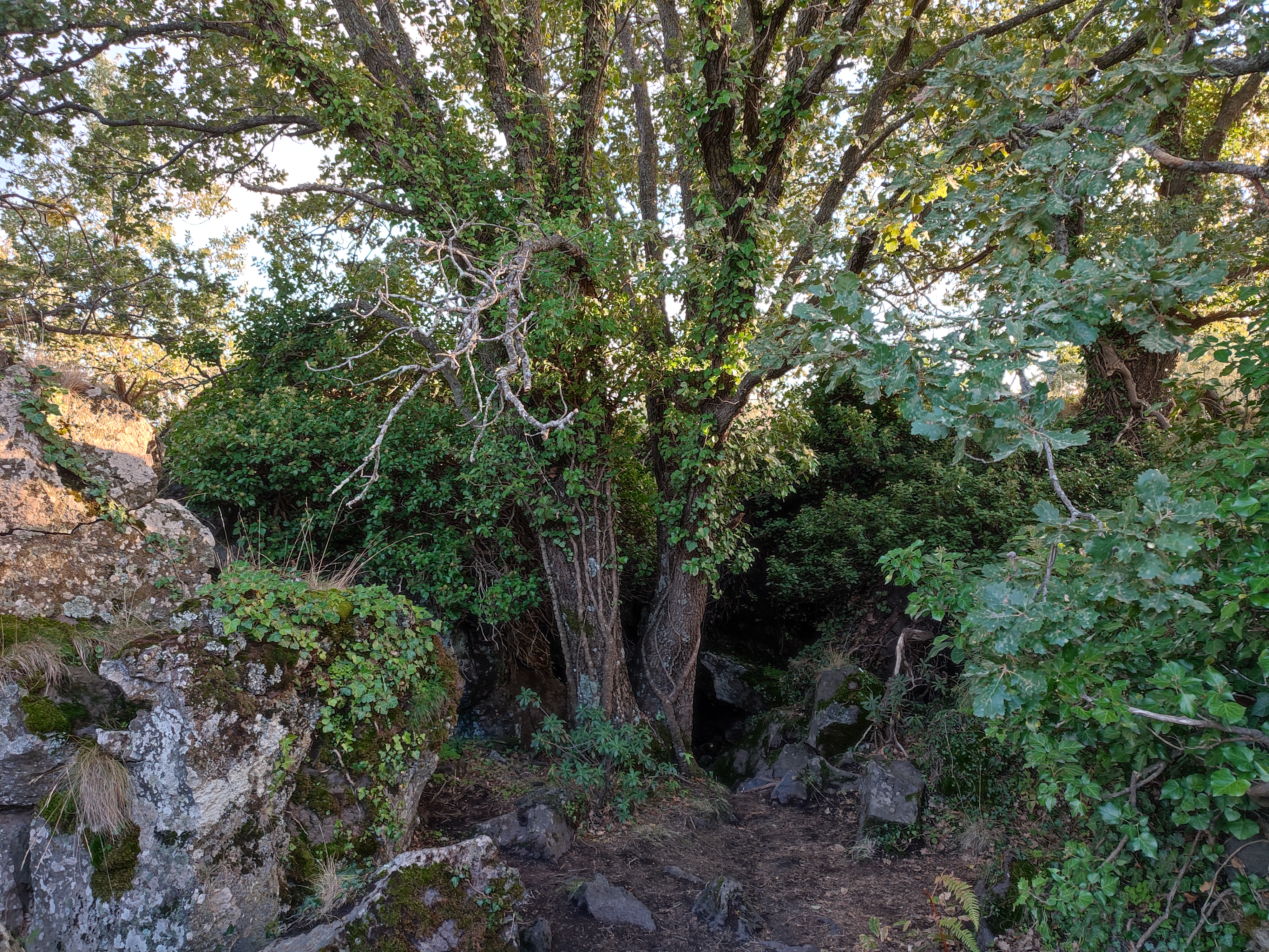
Punto 6 - Grotta dell’immacolata e “pagghiaru ‘n petra”
The cave, reachable through the small path, is about 30 m away heading south. Also visible due to a wooden fence that helps overcome some steps, carved out of the stone, which lead to a depression inside which there are some large specimens of oak and the debris of a vast collapse of the vault. The cave is made up of three different chambers with three different entrances, one to the south, one to the north and one to the west. The three chambers are a few meters wide. The lavas that originated the cave date back to 1780.
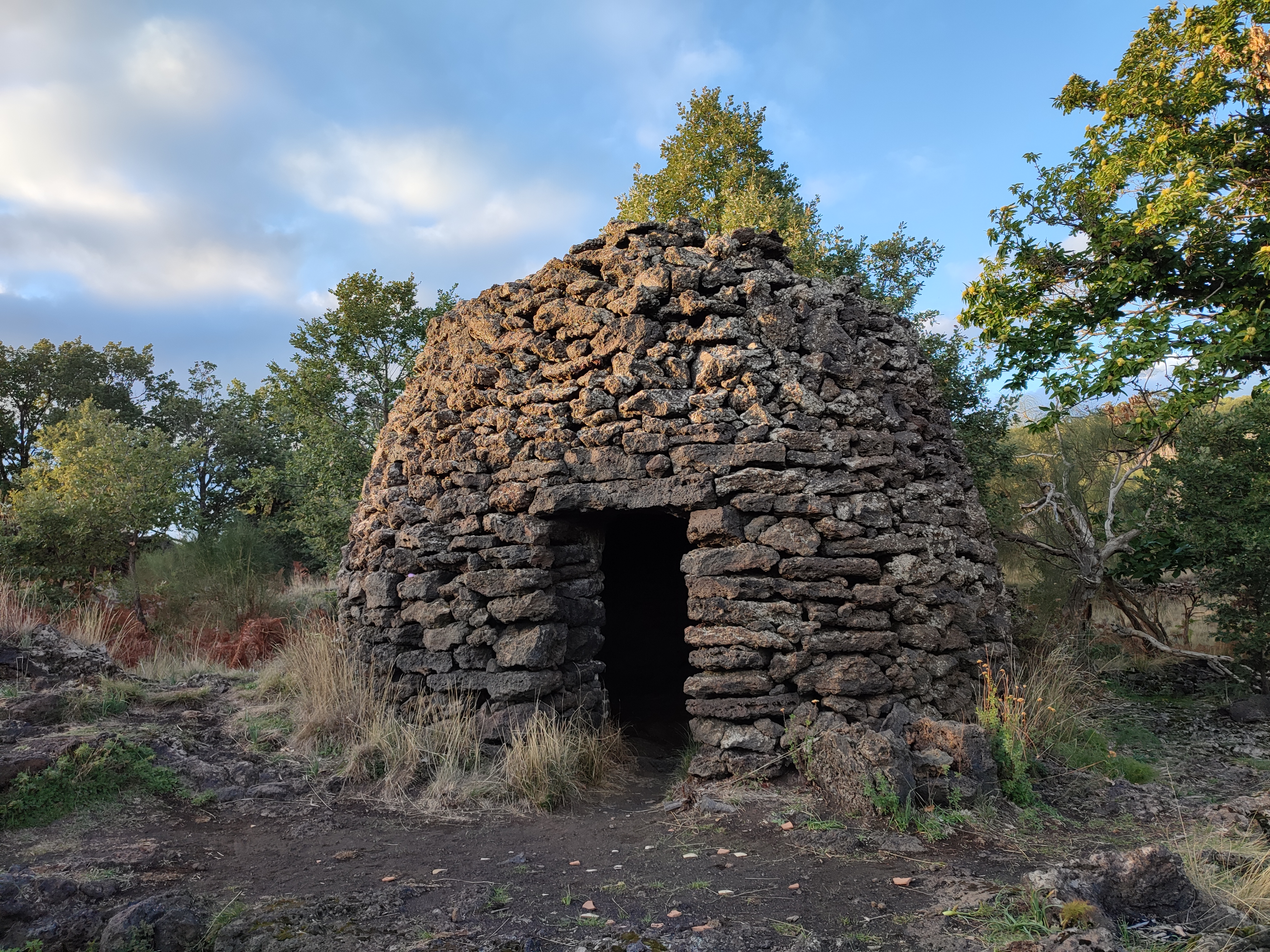
Continuing the path that leads south for about 40 m we reach the “pagghiaru ‘n petra”, that is a haystack made entirely of stone, it represent an ancient construction for the shelter of shepherds or farmers near their herds. This is made entirely of dry lava stone, the plant is circular, has only one access, the structure culminates in a dome made of stones arranged in concentric circles. The stone used for the construction was obtained from the surrounding environment. The lintel of the access door and a cistern with a circular mouth are clearly visible nearly the structure.
Punto 7 – Contrada Serra La Nave
This is an extensive area around Mount Serra La Nave (1661 m.a.s.l.) in the Ragalna area, cloaked in a dense pine forest with specimen tall trees. Nearby there is the Etnean astrophysical observatory called “M.G. Fracastoro” , the “Nuova Gussonea” botanical garden, the little church of Our Lady Of Snows, the adventure park - right inside of the crater basin – and some of accommodation facilities.
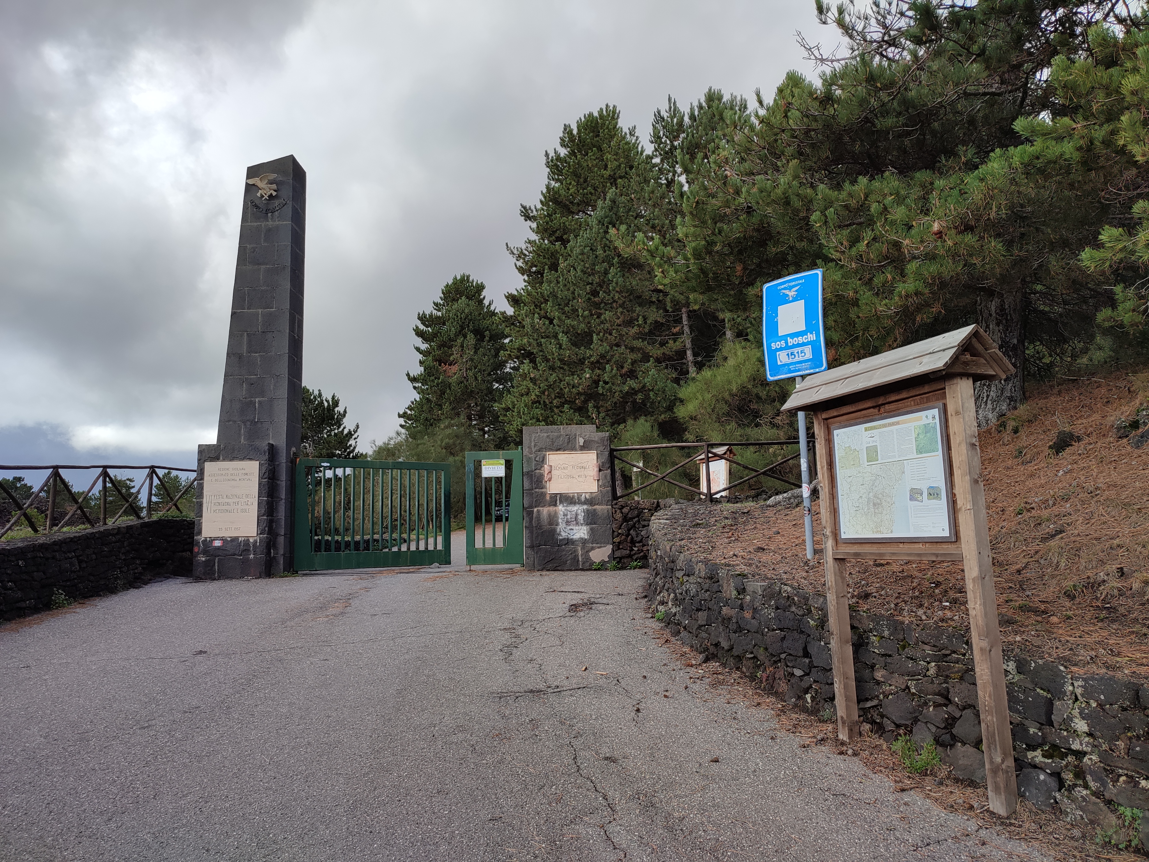
Punto 8 – Cancello Demanio Filiciusa Milia - Ingresso Pista Altomontana
The Altomontana track is a 38-kilometer route that circumnavigates Mount Etna until it reaches the Ragabo di Linguaglossa pine forest on the north side of the volcano.